Building Your Communication Pipeline with Public Works


As industry professionals, we know that the General Plan and zoning ordinance govern the density, intensity, and allowable uses for each parcel located within a local jurisdiction and fall under the auspices of the planning department. However, the provision of service systems such as water, sewer, roads, and other public infrastructure critical to a city’s growth fall under the purview of the Public Works department. In a time when cities and counties are facing housing shortages, failing infrastructure, and preparing for the effects of climate change, local governments are charged with meeting ongoing demands for services, maintaining infrastructure, and continuing to support new development.

the two fields have vastly different training, approaches, and culture, making coordination a frequent challenge.

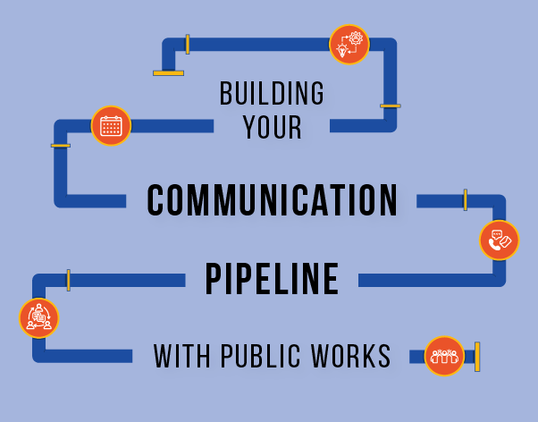
Public works professionals and Planners must meet the needs of the communities they serve, but the two fields have vastly different training, approaches, and culture, making coordination a frequent challenge. Having witnessed this issue with a multitude of jurisdictions across the Bay Area and Northern California, we are inspired to share some best practices that can strengthen the communication pipeline between Planning and Public Works Departments, which can improve application processing, long-range planning, and create efficiencies.

The Early Bird Gets Traction

Getting buy-in from Public Works and other departments is essential to any project or plan’s success and timely completion. While a proposed development project may be of importance to the Planning Department and decision makers, its value may not be immediately apparent to Public Works. Also, they may not be aware of state mandates for completeness review and approvals. The same can be said for General Plans and Specific Plans. It is important to begin the communication process early and to establish protocols, set expectations up-front, identify constraints, and clarify the roles and responsibilities of Planning and those of Public Works. Public Works staff have many responsibilities and it may take multiple tries before you get the response you need. By starting early, you ensure that this does not hold up the project or application processing.

The tone is set by leadership from the top down to create an environment of collaboration and establish communication between the two departments.

Uplevel Your Communications

In an ideal world, Planning and Public Works’ leadership routinely communicate on which projects are forthcoming and what kind of engagement will be needed. The tone is set by leadership from the top down to create an environment of collaboration and establish communication between the two departments. Whether or not leadership takes that initiative, each Planner can set the tone and decide how they interact with counterparts in Public Works. Consider a conversation that touches on at least the following:

  • What is the best way to communicate? (email, phone, in-person?)

  • Are there regular constraints on your calendar?

  • The state gives us 30 days to provide a completeness determination. Within that constraint, how much time do you need to review?

  • Would it be helpful to receive a calendar invite with the deadline?

  • Is there something our department can do to make it easier for you to respond within the state mandated deadline?

  • Would it be helpful to know in advance if we are anticipating an application?

Remember, Public Works professionals are also balancing many competing demands. Approach these exchanges with kindness and an intent to understand. Also, keep in mind that you need them to buy-in. It may not be obvious why your work matters to them, and it is up to you to create that understanding.

Regular Check-Ins

Establish regularly scheduled check-in meetings as an ongoing opportunity for communication. Everyone is stretched thin and involved in too many meetings, but this is one to add to the schedule. Even if it is only a half hour long on a monthly basis, a standing meeting is a critical building block to foster bonds and build awareness of projects in the pipeline. Even if there is “nothing to talk about,” take 15 minutes to give a status update and ask for any updates from the Public Works team. This is an opportunity to build awareness and trust. If you don’t have important agenda items, keep it short. Be sure to create dialog but also respect everyone’s time.

Co-Location

In many jurisdictions, staff are compartmentalized within their department and there is little to no overlap or opportunity for water cooler chat. Co-locating engineers and planners in adjacent or shared spaces creates more than just physical proximity. It creates interdepartmental connectivity through regular interactions that can support a team feel. Even if temporary, co-locating in a shared space can be effective in removing barriers to communication and building bridges to foster connections.

Let’s get digital

There are a number of software programs available that help facilitate interdepartmental review and communication. While sometimes clunky and confusing, these programs will (hopefully) get better over time and can be used to help facilitate review and communication. Even if you only have access to Microsoft Office 365, programs like SharePoint and Planner are great tools (included in the Office suite) that can help facilitate communication and review. While not great for sharing plan sets, Microsoft SharePoint is a great tool to allow for collaborative document writing and review. Microsoft Planner can be an effective way to assign tasks to project team members. It can even send regular reminder emails until the task is checked off as complete. Using these tools can help foster communication and collaboration with effective results and fewer meetings.

Throw your ego out the door and keep your eye on the deadline.

Professional Empathy

Take the time to recognize what challenges your counterpart is experiencing. Recognizing their challenges and timelines can help defuse tension and open the door for them to understand your challenges. A simple, “Hi, I know you are slammed with your projects, but we are required to complete this step by this specific date,” communicates the urgency of the matter while recognizing their challenges and perspective. If you are wondering why you “have to be the bigger person,” the answer is that, as the project manager, it is your job to get the project through on time. Throw your ego out the door and keep your eye on the deadline.

Hard Ball

If you work with someone who is chronically missing deadlines (no judgement), give them a deadline that is a few days earlier than you actually need. Some people only get to things when they are overdue. For the overworked and overwhelmed, it is helpful to set a meeting to discuss their comments on the due date. Send a reminder a day or two before with a casual, “Hey, just checking to make sure you had a chance to look at the document before our call tomorrow. If not, no worries, I’ll walk you through it.” Be friendly, but make sure the message is clear that you aren’t letting them off the hook if they haven’t had a chance to review. The purpose of this meeting is to pin them down. If you are using paper plan sets, meet in person. If your team is using Bluebeam or other digital review software, use Teams or Zoom so that you can get them moving on their review. Further, it helps to call out some specific issues ahead of time. For example, “I’m hoping you can weigh in on whether the plans have sufficient information for you to review the water and wastewater connections for the 180 new units.” Or, “the Specific Plan calls for an additional 1,000 units in the area, we need your help in understanding infrastructure capacity.”

We all serve the public, and our goal is to ensure a positive future for the cities and counties we serve.

Remember

We all serve the public, and our goal is to ensure a positive future for the cities and counties we serve. We can’t do it without building interdepartmental relationships and working together. Be kind, be sincere, say thank you, and remember we are all human. It may take time for your efforts to bear fruit. As Planners, we are project managers. By implementing best practices and clearing the communication pipeline with Public Works, we can foster long-term relationships to create better plans, make development review more effective, and allow us to better serve our jurisdictions.

M-Group can help!

If you are struggling to communicate with your Public Works team, M-Group provides short Public Works-focused presentations on planning topics such as State housing laws, the Permit-Streamlining Act, ministerial review, and CEQA. These presentations help Public Works staff understand timelines and requirements that can serve as a critical building block for mutual understanding.

By Heather Gurewitz, AICP, Senior Planner

How Schools are Overcoming Financial Barriers to Meet Housing Needs

Introduction, Impediments to Student Housing

Colleges and schools are building housing to address a growing affordability crisis in the Bay Area and elsewhere on the West Coast. High housing costs directly impact these institutions’ ability to attract and retain staff, and the resulting attrition comes with steep financial consequences. For instance, attrition has been estimated to cost school districts in San Francisco and Oakland over $11 million and $12 million annually, respectively (1).

However, financing new housing remains a significant obstacle for many colleges and schools because they do not have the internal capacity to function as developers and landlords. Moreover, increasing reliance on debt to finance new housing can raise long-term sustainability concerns. Rising construction costs further complicate matters, even as new state laws streamline the entitlement process.

Yet, high occupancy rates and long waitlists signal that demand for affordable housing is higher than ever, particularly in high-cost areas. For instance, staff housing built by Santa Clara Unified School District has been occupied at near full capacity — with an extensive waiting list — since its construction in 2002, particularly for much sought-after two-bedroom units (2). This is also true for student housing. Despite opening a new housing project in 2023, students at Santa Rosa Junior College are encouraged to apply early because limited supply is prioritized for low-income students before being allocated on a first-come, first-serve basis (3).  In response, schools are adopting innovative financing strategies to build housing. From public-private partnerships (P3s) that leverage the tax-exempt status and bond funding available to institutions to donor-driven campaigns and grant funding opportunities, developing and operating housing often requires a uniquely complex combination of funding and collaboration. Partnerships with public and private entities are becoming increasingly critical because they bring expertise and resources that schools may lack (4).

Schools are adopting innovative financing strategies to build housing. From public-private partnerships (P3s) that leverage the tax-exempt status and bond funding available to institutions to donor-driven campaigns and grant funding opportunities, developing and operating housing often requires a uniquely complex combination of funding and collaboration.

The following examples from the Bay Area and other parts of the West Coast illustrate how schools are being resourceful in addressing challenges tied to developing staff and student housing.

Public-Private-Partnerships using Low-Interest Bonds – Santa Rosa Junior College

A public-private partnership (P3) is a collaboration between public institutions and private developers to help finance and manage projects. These partnerships have become a leading strategy for financing campus housing because they allow schools to consolidate resources and risks with outside parties (5). Schools avoid the full financial and operational burden of housing projects, while developers gain stable, long-term investment opportunities. This happened at Santa Rosa Junior College (SRJC), who partnered with a non-profit developer, National Campus and Community Development Corporation (NCCD), to build on-campus housing.

Opened in the Fall of 2023 at a cost of $75 million, Polly O’Meara Doyle Hall houses 330 students in dormitories with shared amenities. Aligned interests between the school and developer were pivotal to the project’s success. Rather than directly financing the project, SRJC made their land available while NCCD secured tax-exempt bonds through the California School Finance Authority (6). Low interest rates (4.5%-5.5%) over the 40-year life of the bond — paired with high-demand for housing offer NCCD low-risk investment while they retain ownership of the project. Once the bonds are fully repaid, ownership transfers to the college. A model that NCCD has replicated at Orange Coast College, Napa Valley College, and California College of the Arts (7).

For SRJC, this partnership provides facility and operational savings from leveraging NCCD’s expertise, while bond provisions ensure the college maintains control over programming that is aligned with its academic mission.

Polly O’Meara Doyle Hall at Santa Rosa Junior College – Photo Credit: HPI Architecture

Tax-Exempt Land Leases – San Mateo County Community College District

Public-private partnerships are also being used to build housing for school faculty and staff, particularly in high-cost areas. Schools are taking advantage of their tax-exempt status to provide affordable rents to employees (8). Tax exemptions available to public schools and private colleges eliminate liabilities that often inflate project costs. By leasing their land to developers, both parties avoid the tax risk associated with traditional housing projects. This reduces hard costs and enables substantially lower rents.

By leasing their land to developers, both parties avoid the tax risk associated with traditional housing projects. This reduces hard costs and enables substantially lower rents.

This is exemplified by the Employee Housing Program offered by the San Mateo County Community College District (SMCCD), which successfully developed affordable housing on the Cañada College, Skyline College, and College of San Mateo campuses. Apartments built on previously underutilized SMCCD land offer rents that are nearly half the local market rate (8). The projects are tax exempt under California’s Welfare Exemption because they directly support the educational objective of the district (9). Because the project was developed at a much lower cost than what is typical of traditional housing, the rents are still able to cover operating costs, reserves, and debt without relying on the district’s general funds. Inspired by similar efforts in the Santa Clara Unified School District, this type of public-private partnership is becoming a common strategy for developing both staff and student housing in high-cost areas (10).

That said, complications sometimes arise in meeting eligibility requirements. In high-cost areas, staff incomes may exceed the thresholds needed to qualify for very low-income and low-income housing funds. For instance, teachers in San Francisco have faced difficulties accessing housing intended for them because their incomes exceed 30 and 60 percent of the area’s median income (1,11).

In addition, some jurisdictions may request payment in-lieu of taxes (PILOT) to help offset lost property tax revenue. In California, properties qualifying for the Educational or the Welfare Exemption are exempt from property taxes. Local governments may negotiate PILOT agreements with property owners to compensate for lost tax revenue needed to cover city services. These agreements are not mandated by state law, but they are permissible and may be necessary in some low-income areas that struggle to fund services (12).  

Faculty Housing at Skyline College in San Mateo County – Photo Credit: Haley Lan

Donor-Driven Financing – Jesuit Housing at Gonzaga University

Smaller private schools may not have access to the same public funding available to public schools. Instead, some private institutions are drawing on donors to fund housing — particularly when the new buildings are meant to serve a specific purpose.

At Gonzaga University in Spokane, Washington, the school launched an unprecedented fundraising effort to fund several university initiatives. This included the construction of the Della Strada Jesuit Community, a facility that provides housing for priests serving the university, its preparatory school, and other local ministries. Located near the center of campus, it connects students and faculty to the spiritual mission of the university.

Opened in 2017 at a cost of about $13 million, the 36,074-square-foot facility has 22 living quarters and includes offices, a chapel, and supportive spaces for the Jesuit priests (13). The funding for Della Strada was made possible by a significant contribution from an alumnus, inspired by his own experiences learning from the Jesuit community.

The donation came as a part of 'Gonzaga Will,' conceived seven years prior as the largest fundraising campaign in the school’s history. Ultimately, the fundraising effort greatly surpassed expectations of an already ambitious goal — $250 million — raising over $355 million from more than 40,000 donors (14).  

Private schools, though exempt from property taxes, may not have access to the same funding mechanisms as public schools and may find it effective if they can tap into their donor networks to support housing initiatives.

Private schools, though exempt from property taxes, may not have access to the same funding mechanisms as public schools and may find it effective if they can tap into their donor networks to support housing initiatives.

Della Strada Jesuit Community at Gonzaga University in Spokane, Washington – Photo Credit: BAR Architects & Interiors

Grant Funded Housing – Project Homekey at Imperial Valley College

When partnerships and donations fall short, grant funding can help fill the gap — particularly to address acute housing needs of disadvantaged students. Grants are highly competitive, but shovel-ready projects can help institutions act quickly when funds become available. Imperial Valley College (IVC) in Imperial, California, successfully applied for State Project Homekey funds to address the urgent needs of students experiencing housing insecurity.

Grants are highly competitive, but shovel-ready projects can help institutions act quickly when funds become available.

Project Homekey was established by the state in June of 2020, dedicating $846 million to convert vacant hotels and other properties to housing to combat homelessness (15).  In partnership with the City of El Centro, IVC used these funds to develop Lotus Living Tiny Homes, a 26-unit community for students experiencing housing insecurity built on an acre of vacant land near the IVC campus provided by the city (16).

Securing funding did not come without challenges. IVC applied for a local Homeless Emergency Aid Program (HEAP) grant but was initially unsuccessful. Soon after, the City of El Centro informed IVC of available Project Homekey funds, however the application needed a quick turnaround. With only three days to complete the application, IVC drew from their HEAP application, with much of the necessary information already prepared and ready to submit.

This also expedited construction and reduced costs once funds were secured. Less than three months after the city filed the Homekey application, an interdisciplinary team of city officials, technical experts, and IVC leadership quickly brought the project to fruition (17).

Lotus Living Tiny Homes near Imperial Valley College in El Centro, California – Photo Credit: Back Porch Tiny Homes

Conclusions

Every school faces unique circumstances in securing the funds to build housing. Public schools can leverage their tax-exempt status in partnership with developers and draw on a wide range of funding mechanisms available at the state level. Private schools can also leverage tax-exemptions but may not qualify for the same funding as public schools — to bridge the gap, they can draw on strong donor networks to support their mission.

Schools in economically disadvantaged areas can capitalize on grant opportunities by being prepared with shovel-ready projects when funding becomes available. While every project is unique, success often depends on a combination of creativity, collaboration, and strategic planning to overcome financial hurdles.

By Lorrin French, Assistant Urban Designer

Sources

1.      Christopher, Ben. “To Attract Teachers, Pricey School Districts Are Becoming Their Landlords.” CalMatters, 1 Mar. 2017, http://calmatters.org/education/2017/03/to-attract-teachers-pricey-school-districts-are-becoming-their-landlords/.

2.      Creating Workforce Housing: Kemp Models of Excellence. Urban Land Institute, 2012, https://uli.org/wp-content/uploads/2012/06/One-Pager-Casa-del-Maestro.pdf

3.      On Campus Housing | Housing. https://housing.santarosa.edu/campus-housing.

4.      Jones, Carolyn. “California Is Giving Schools More Homework: Build Housing for Teachers.” CalMatters, 13 Aug. 2024, http://calmatters.org/education/k-12-education/2024/08/affordable-housing/.

5.      HGA. “Creating Campus Value Through Developer-Led Student Housing.” HGA, 19 Nov. 2021, https://hga.com/creating-campus-value-through-developer-led-student-housing/.

6.      Staff Summary - Sonoma County Junior College District Project. California School Finance Authority, 2020, https://www.treasurer.ca.gov/csfa/meeting/2020/20200924/staff/4.pdf.

7.      National Campus and Community Development Corporation. https://nccdevelopment.org/. Accessed 27 Nov. 2024.

8.      Teacher Housing in California – Education Housing Partners, Inc. – Thompson Dorfman LLC. https://www.thompsondorfman.com/teacher-staff-housing/. Accessed 2 Dec. 2024.

9.      Welfare Exemption for Low Income Rental Housing and Supplemental Clearance Certificate Requirements for Limited Partnerships. https://www.boe.ca.gov/proptaxes/welfarelowinc.htm. Accessed 2 Dec. 2024.

10.  HGA. “Creating Campus Value Through Developer-Led Student Housing.” HGA, 19 Nov. 2021, https://hga.com/creating-campus-value-through-developer-led-student-housing/.

11.  2024 Maximum Income by Household Size. San Francisco Mayor’s Office of Housing and Community Development, 30 Apr. 2024, 2024 AMI-IncomeLimits-HMFA_0.pdf.

12.  PILOT Agreements and Their Potential Impact on a Low-Income Housing Development’s Welfare Exemption. California State Assembly Committee on Housing and Community Development, 30 Jan. 2014, https://ahcd.assembly.ca.gov/sites/ahcd.assembly.ca.gov/files/Draft%20White%20Paper%28v10%29.pdf.

13.  New Housing Built for Jesuits at Gonzaga, Gonzaga Prep | The Spokesman-Review. https://www.spokesman.com/stories/2017/sep/30/new-housing-built-for-jesuits-at-gonzaga-gonzaga-p/. Accessed 2 Dec. 2024.

14.  Martin, Arcelia. “The Della Strada Jesuit Community Becomes a New Home for 20 Jesuits.” The Gonzaga Bulletin, 29 Nov. 2017, https://www.gonzagabulletin.com/news/the-della-strada-jesuit-community-becomes-a-new-home-for-20-jesuits/article_3ddf73f0-d57e-11e7-b428-230b36b9bbe2.html.

15.  Homekey: California’s Statewide Hotels-to-Housing Initiative. National Alliance to End Homelessness, 19 July 2021, https://endhomelessness.org/wp-content/uploads/2021/07/CA-H2H-Case-Study_7-19-21.pdf.

16.  Lotus Living Tiny Homes. Enterprise Community Partners, https://www.hcd.ca.gov/sites/default/files/docs/grants-and-funding/homekey/Homekey-COVID-Response-EL-CENTRO.pdf.

17.  Kirby, Kayla. “Tiny Home Project Completed, 26 Homeless Students to Receive Keys and Move in Soon.” The Desert Review, 7 May 2021, https://www.thedesertreview.com/education/tiny-home-project-completed-26-homeless-students-to-receive-keys-and-move-in-soon/article_1a244042-af98-11eb-afa2-7397f28a33f2.html.

Looking for Land in a Busy City? You Can Use GIS...and Ai

The rise of Artificial Intelligence (AI) is changing the way our society looks and interacts with data. AI, combined with the expanding tools of Geographic Information Systems (GIS), allows for dramatically more efficient data visualization and cost-effective analysis.

As part of my Masters of Urban Planning Capstone project at San Jose State University, I was tasked with identifying the acreage of surface parking lots in our North San Jose study area. This meant finding parking lots on nearly 4,000 acres (over six square miles) of land or identifying hundreds of pools from the view of an airplane window.

Rather than use Google Earth or spend many hours exploring the site area, I made a map using ArcGIS Deep Learning Model, specifically the Parking Lot Classification Tool. This analyzes a raster image file (a digital image file, like JPEGs or TIFFs), pixel by pixel, creating a separate layer designating areas as parking lots as appropriate.

In simple terms, the model looks for color patterns in the picture and provides a data output for visualization, similar to tasking a person with sorting a bag of colored beads. All the grey (parking lot) goes in one pile, and all the others in another pile. It took me just a few hours of developing and modifying a task, then I let the computer run for a few days, to determine that approximately 16% (640 acres, 1 square mile) of the project area is covered by surface parking.

Parking Lot Identification

The mapping process, much like a GIS map itself, is made of layers. Before starting in ArcGIS Pro, I conducted background research. There are many different models, some Deep Learning models are trained to detect objects like cars or to detect pixels for classification, while others detect change over time.

To begin, I used a TIFF file, or a high-quality raster image file, provided by the City of San Jose. In ArcGIS Pro, I imported the raster file and the study area boundary layers, matching the image to the shapefile. After this was the most difficult part: training the model for more accurate results. In order for the program to recognize the various grey patterns and shades of the parking lots – as opposed to the grey of streets or rooftops - I developed training samples for the Parking Lot Classification model. This required creating a new feature class and manually outlining small parking lot section polygons over the aerial image raster file layer.

Figure 1: Parking Lot Classification Model Training Sample Polygons

Once exportation of the training data was complete, I used the Classify Pixels Using Deep Learning tool. After about 70 hours of background runtime using a gaming PC, the preliminary map was complete, more accurately identifying parking lots in purple.

To clean up Figure 2 to Figure 3, I used the Dissolve and Smooth Polygon tools to combine the yellow and purple layers and smooth out the jagged edges of the polygons to create the final parking lot map below.

Figure 4: Map of North San Jose with parking lots shown in a yellow color (Map produced by Hannah Meeks, Fall 2023 URBP 295, City of San Jose Open GIS Data Portal: Santa Clara County 2022 Imagery basemap. Valley Water Open Data Portal: Rivers for Study Area Boundary. Self-Created: Highway Shields.

Applying AI to Planning Practice

The study area is primarily made up of industrial/commercial facilities, home to many large tech companies such as Samsung, Cisco, and PayPal. There is a small amount of mixed-use commercial and residential development as well.

The parking lot analysis showed that a tremendous amount of the study area was dedicated to vehicle parking: land that is essentially storage, and un-activated outside of rush hour or folks grabbing lunch.

As transit options continue to improve, and the private car (or pickup truck, or SUV) loses its primacy in the Bay Area, parking lots represent development potential. The transformation of existing parking lots provides fantastic infill opportunities. This could mean civic or public space – including desirable green spaces – as imagined by Gensler’s architecture firm, Los Angeles cultural center The Mod, as seen in this Curbed article Parking Garages Are Getting a Second Life as Places for People.

Figure 5: Modular buildings inserted into existing parking garage. Image source Curbed

Figure 6: Parking garage used as public space. Image source Curbed

It could also mean much more affordable housing. Not just specially-built affordable housing, but simply dramatically reducing the cost of market-rate housing. According to NPR, parking spaces “can add major costs to building new housing: a single space in a parking structure can cost $50,000 or more.”

Finally, parking spaces too often contribute to urban heat islands. As described in my colleague Laylonni Laster’s article, “heat islands are areas where structures such as buildings, roads, and other infrastructure that absorb and re-emit solar heat are highly concentrated and natural landscapes are minimal…Materials, such as pavements or roofing, tend to absorb and emit solar energy rather than reflect it…Therefore, these materials can contribute to the increase in local temperatures and foster heat island development.”

Urban heat islands pose serious health risks, including heat exhaustion and heat-related illnesses for vulnerable communities, including seniors, and elevates energy consumption, which increases air pollutants and greenhouse gas emissions. The pavement decreases water quality as polluted runoff collects in streams and rivers and impacts aquatic life.

Each of my telltale grey pixels was an area that contributed to urban heat and the health risks they incur. Identifying – and eventually removing - these parking lots can help promote climate change initiatives by policymakers with the addition of plants, trees, and other green spaces to reduce climate change effects.

How does GIS answer planning questions?

When I first began this GIS Deep Learning project it felt overwhelming, but as I researched and accomplished each step, it was attainable. Our project would never have discovered the impact of surface parking lots in this area without the Deep Learning tool. For GIS technicians, it is important to understand when we must execute the GIS steps ourselves versus when we need additional GIS tools in order to solve the community’s needs.

AI is not a solution to all urban planning problems, not by a long shot. But what careful application of computer learning can do is increase the efficiency of some tasks, and deliver more careful analysis to a community’s elected leaders. By taking advantage of built-in processes like the Deep Learning tool, M-Group can work with jurisdictions to provide efficient GIS solutions to communities to ask questions they might not have believed they could afford to ask.

By Hannah Meeks, Assistant Planner

The Secret Weapon in the 6th RHNA

The Bay Area Greenprint: The Secret Weapon For Addressing Climate Change In The 6th RHNA And How To Use It

Homepage screenshot www.bayareagreenprint.org

Homepage screenshot www.bayareagreenprint.org

As planners embark on finding the appropriate housing opportunity sites for the 6th Regional Housing Needs Allocation (RHNA), it is critical to consider the influence that climate change will have on these new developments, the public health and safety of future inhabitants, and the surrounding ecosystems. Although evaluating the impacts of climate change requires on-the-ground site assessment and thoughtful conversations with neighbors, businesses, and city leaders, there is an online planning tool that can help jumpstart your work in building resiliency into your new housing development decisions. The Bay Area Greenprint is the region’s premiere environmental assessment tool whose user-friendly features are highlighted in a previous post, Bay Area Greenprint - An Exciting and Efficient New Tool for Bay Area Planners. In fact, the Metropolitan Transportation Commission (MTC) has found the tool so useful that the agency is using the Bay Area Greenprint’s environmental data in their new Site Selection tool to assess the environmental viability of city and county housing opportunity sites, and you can too! 

The potential impacts of climate change and the plausible solutions to address global warming are all around us. The Bay Area Greenprint provides a one-stop-shop for climate data across several categories, including Carbon and Air Quality, Water, Agriculture, Urban Greening, and Wildlife that can be applied for both open space preservation and urban infill decisions. Understanding these opportunities and tradeoffs can provide planners with essential strategic direction when considering new development and conservation decisions for the 6th RHNA cycle. As jurisdictions continue to build out in accordance with their general plan, the edge areas of open space around the built-up areas offer a chance to conserve lands for resiliency against the effects of climate change from sea-level rise, for wildlife resiliency, and contribute to carbon sequestration. On the flip side, the infill opportunity sites across the region can play their part in making sure we are creating safe and healthy places for people to enjoy their urban lifestyles even under a shifting climate.

When evaluating the landscape for urban edge housing opportunities, perhaps you’ve wondered about the contribution of vegetation to sequester carbon dioxide and nitrogen oxide? Or you’ve heard the Sustainable Groundwater Management Act (SGMA) has recommended the evaluation of Groundwater Dependent Ecosystems to local groundwater management plans. These new and other Bay Area Greenprint layers can provide a quick evaluation for your project area to ensure new development plans prioritize preserving valuable ecosystems that will be more resilient towards mitigating the impacts of climate change.

Considering the quality of life for new residents is especially challenging to predict under a warmer climate. However, the Bay Area Greenprint offers recommendations to help planners prioritize tree planting to address the urban heat island effect and mitigate air pollution. It can also ensure new development plans incorporate access to parks, bike lanes, and regional trails. Having easy access to outdoor amenities in every neighborhood can help foster community and promote more active and healthy lifestyles as well as reduce automobile emissions. Another important layer in the tool helps inform planners and developers about the threat posed by environmental gentrification that occurs when the urban amenities you plan for in a neighborhood end up leading to the displacement of the existing residents you were trying to help.

This information and much more is just a click away in Bay Area Greenprint! It was created to be a ‘living tool’ that responds to the needs of users and will continue to play this role in the future. Your feedback, thoughts, and recommendations go a long way towards helping other planners with the same questions you’re wrestling with. To learn more about how to take advantage of this free easy-to-use tool, check out the recent Bay Area Greenprint webinar. Feel free to get in touch with Adam Garcia (agarcia@m-group.us) for any questions you might have about navigating this useful environmental planning tool.

DON'T LEAVE $$ ON THE TABLE

By Michelle Audenaert, AICP Associate Planner at M-Group

sb2 GRAPHIC.jpg

A great opportunity is available to California cities and counties through November 30, 2019.  The Department of Housing and Community Development, “HCD,” is offering a non-competitive grant to accelerate housing production through encouraged Priority Policy Areas.  Cities and counties can request up to $160,000; $310,000; or $625,000 depending on their recorded populations of less than 60,000, between 60,001 to 199,999 or over 200,000 respectively.  Grant monies have been gathered through a $75 real estate transaction fee enacted by State Bill 2 in 2017.

Cities and counties may use the funds for a wide variety of activities such as updates to plans or zoning ordinances, planning and building process improvements (including new permit software), and new ordinances that allow for by-right housing permits or objective design standards.  Applications that focus on Priority Policy Areas will require less paperwork and possibly have a shortened review time after submittal. 

Another aspect to note is the minimal requirements for official reporting.  These SB2 grant applications only require one report at close-out to trigger reimbursement of the funds, which must be spent by June 30, 2022.  At the conclusion of each project activity, jurisdictions can submit funding reimbursement requests to HCD.  Entities that are concerned about internal funding availability may incorporate several smaller projects into one application to allow for earlier multi-part reimbursements.

APPLICATION COMPONENTS

Cities and counties wishing to apply for SB2 grant funding must have an HCD-compliant housing element and have submitted Annual Progress Reports for 2017 and 2018.  Once these pieces are in place, applications must include a list of application activities, certification that these activities fall under State or Other Planning Priorities, a project narrative and a budget.  A standard resolution authorizing staff to enter into a contract with HCD must be ratified before the application deadline. “The application must demonstrate a significant positive effect on accelerating housing production through timing, cost, approval certainty, entitlement streamlining, feasibility, infrastructure capacity, or impact on housing supply and affordability.”

Priority Policy Areas:

(a) Rezone to Permit By-right housing;

(b) Objective Design and Development Standards;

(c) Specific Plans or Form based Codes Coupled with CEQA Streamlining;

(d) Accessory Dwelling Units (ADU) or Other Low-Cost Building Strategies;

(e) Expedited Processing;

(f) Housing Related Infrastructure Financing and Fee Reduction Strategies.


State Planning Priorities:

1) Promote Infill and Equity

2) Promote Resource Protection- ag lands, natural lands, recreation lands, locally unique landscapes

3) Encourage Efficient Development Patterns


Other Planning Priorities:

4) Affordability and Housing Choices

5) Conservation of Existing Affordable Housing Stock

6) Climate Change/ Climate Adaptation – flood, fire, vulnerable populations


NEXT STEPS

Given the short timeframe for application submittal, focusing on the adoption of HCD’s standard resolution at the City Council or Board of Supervisors and on determining project focus is key.  The application paperwork is not overly complicated, and HCD has indicated a desire to work with cities and counties toward mutually indicated goals (through an “over-the-counter process”).  Once this initial non-competitive grant round has ended, HCD has the option to open a new round of applications that would be competitive for remaining funds. Don’t miss out on this chance for funding for your city’s or county’s projects.

M-GROUP planners are well-versed in the SB2 grant process, having provided support for the following grant applications:

·         City of Cotati: $160,000 funding approved

·         City of Sebastopol: $160,000 in process

·         County of San Benito: $160,000 in process

·         City of Petaluma: $310,000 application in process

Contact M-GROUP today to get your jurisdiction’s grant application started.

408.340.5642 x111

Identifying and Managing Wildfire Risk in California

by Lisa Davison, Environmental Planner at M-Group

Home surrounded by wildland that survived a fire due to good defensible space. Source: 2010 Strategic Fire Plan for California, April 2016

Home surrounded by wildland that survived a fire due to good defensible space. Source: 2010 Strategic Fire Plan for California, April 2016

California experienced one of the most devastating wildfire seasons in 2017, with a total of 7,117 fires burning 505,956 acres. The fires in Sonoma and Napa counties burned 146,647 acres and destroyed nearly 8,000 structures in October, accounting for approximately 30 percent of the acreage burned in 2017. The fires in Ventura, Santa Barbara, and Los Angeles counties burned 303,561 acres and destroyed 1,120 structures in December, and accounted for approximately 60 percent of the acreage burned in 2017.

California is at great risk from wildfires because of its particular combination of weather, topography, and native vegetation. Southern California has the added risk of the Santa Ana winds that appear in the spring and late fall. Fire risks have increased with drought conditions, population growth, and increased development within the wildland-urban interface.

This article describes the various entities that are responsible for identifying and managing wildfire risk in California in order to minimize the loss of life and property from wildland fires in the future.

State-level Responsibilities

The California Department of Forestry and Fire Protection (CAL FIRE), State Board of Forestry and Fire Protection, and the California Building Code serve as the building blocks for identifying and managing wildfire risk at the state level.

CAL FIRE Mapping

CAL FIRE is required by law to map areas of significant fire hazards based on fuels, terrain, weather, and other relevant factors. CAL FIRE’s Statewide and County maps (adopted November 2007) depict Fire Hazard Severity Zones (FHSZs)[1] that are within the State Responsibility Area (SRA). The SRA identifies where the State of California is financially responsible for the prevention and suppression of wildfires. The SRA does not include lands within city boundaries or in federal ownership. The FHSZs in the SRA are further classified as being Moderate, High, or Very High.

[1] The FHSZs identify fire hazard, not fire risk. “Hazard” is based on the physical conditions that give a likelihood that an area will burn over a 30 to 50-year period without considering modifications such as fuel reduction efforts. “Risk” is the…

[1] The FHSZs identify fire hazard, not fire risk. “Hazard” is based on the physical conditions that give a likelihood that an area will burn over a 30 to 50-year period without considering modifications such as fuel reduction efforts. “Risk” is the potential damage a fire can do to the area under existing conditions, including any modifications such as defensible space, irrigation and sprinklers, and ignition resistant building construction which can reduce fire risk.

In addition, CAL FIRE has prepared recommendations for Very High FHSZs in those areas where local governments have financial responsibility for wildland fire protection, known as Local Responsibility Areas (LRA). Only lands zoned as Very High FHSZ are identified within the LRA. In 2008, CAL FIRE transmitted those recommendations to all local agencies with identified Very High FHSZs. However, this process has its limitations. First, because CAL FIRE only transmits the areas identified as Very High FHSZs to the local agencies, there could be some Moderate or High FHSZs within the LRA that are not being identified. Second, the CAL FIRE zoning designations do not go into effect until they are adopted by ordinance by local agencies. Last, the maps were created in 2008 and reflect outdated information. CAL FIRE is currently in the process of updating the FHSZ maps (Feb 2018).

pic2.jpg

Currently, CAL FIRE is investigating methods for estimating the likelihood of fire occurrence across the State in the coming decades. As part of this effort, CAL FIRE has created a map of annual fire probability for the period 2026-2050. This map is intended for use in the quantification of GHG benefits of fuel reduction activities funded under the 2016-17 Greenhouse Gas Reduction Fund Forest Health Program

Strategic Fire Plan for California

The 2010 Strategic Fire Plan for California (revised April 2016) was developed by the State Board of Forestry and Fire Protection and CAL FIRE. The plan’s vision is to support a natural environment that is more resilient and ensure that man-made assets are more resistant to the occurrence and effects of wildland fire. The plan identifies goals and objectives that are critical to reducing and preventing the impacts of fire, which revolve around both suppression and fire prevention efforts.

The first goal of the plan relates to the identification and evaluation of wildland fire hazards and recognizing the life, property and natural resource assets at risk. One of the objectives under this goal is to provide regular updates to the Very High FHSZ maps. Another objective under this goal is to update existing data for values and assets at risk utilizing GIS data layers and other mapping solutions.

California Building Code

To help manage wildfire risk at the state level, the California Building Code (CBC) contains standards for building materials, systems, and or assemblies used in the exterior design and construction of new buildings. For example, the 2016 CBC establishes minimum standards for the protection of life and property by increasing the ability of a building located in any FHSZ within SRA or any Wildland-Urban Interface Fire Area to resist the intrusion of flames or burning embers projected by a vegetation fire. (A Wildland-Urban Interface Fire Area is a geographical area identified by the state as a FHSZ, or other areas designated by the local agency to be at a significant risk from wildfires.)

However, the 2016 CBC standards have limitations. The standards only apply if: 1) the building site is located on land designated as a FHSZ or as a Wildland Interface Fire Area; and 2) the application for the building permit was submitted on or after July 1, 2008. Therefore, these standards do not apply to structures located outside of these designated areas. Additionally, these standards do not apply to structures for which building permit applications were submitted prior to July 1, 2008, regardless of their designation.

Local-level Responsibilities

Local agencies are responsible for identifying and managing wildfire risk within their jurisdictions. Cities and counties have multiple tools at their disposal to reduce wildfire risk, such as the General Plan, zoning ordinance, California Government Code, local fire departments, and Hazard Mitigation Plans. With new levels of concern regarding wildfires, local jurisdictions can evaluate their General Plans and zoning ordinances to locate weaknesses and bolster mitigation strategies related to wildfire hazards. Local jurisdictions can also create overlay zoning or overlay districts for areas prone to wildfires that mandate heightened development regulations and landscape wildfire mitigation compliance measures.

Local jurisdictions may rely on the support of regional agencies, such as the Association of Bay Area Governments (ABAG), which runs the Resilience Program to support local governments in planning for wildfires and other natural hazards. ABAG’s Mitigation and Adaptation Plans project supports the ongoing development of hazard mitigation and climate adaptation plans at the local level.

In addition, local government agencies receive guidance from State agencies, such as CAL FIRE and the State Board of Forestry and Fire Protection. The local government agencies can then implement recommendations through the enactment of ordinances. However, it is ultimately the responsibility of the local agencies to identify and manage wildfire risk within their jurisdictions.

Individual-level Responsibilities

In order to reduce risks associated with wildland fires at the individual level, California Government Code Section 51182 identifies specific strategies to be undertaken by a person who owns or leases an occupied dwelling or structures in, upon, or adjoining a mountainous area, forest-covered land, brush-covered land, or land within a Very High FHSZ. Strategies include maintaining defensible space around the structure, removing dead portions of trees near structures, and maintaining the roof clear of leaves, needles, or other vegetative materials. As stated in the California Government Code, local agencies having jurisdiction over the property can provide oversight to ensure that these mitigation strategies are implemented.

Conclusion

Wildland fire is a natural part of California’s landscape. The responsibility for identifying and managing wildfire risk in California is shared by the State, local jurisdictions, and individual property owners.

As a starting point, areas of significant fire hazards must be accurately mapped, routinely updated and property owners informed of risks. Local jurisdiction must impose restrictions through their land use regulations and long-range planning efforts to ensure that high risk areas are protected. Individual property owners must maintain defensible space, remove dead portions of trees, and keep roofs clear of vegetative materials.

Moving forward, dialogues will continue to take place within communities to identify wildfire-related risks and propose actions to reduce these threats. These discussions will propel local communities towards their own solutions to prepare for and reduce wildfire-related risks.

References

2016 California Building Code, Part 2, Volume 1, Chapter 7A – Materials and Construction Methods for Exterior Wildfire Exposure, https://codes.iccsafe.org/public/chapter/content/9997/, Accessed October 24, 2017.

CAL FIRE, California Fire Hazard Severity Zones Maps, http://calfire.ca.gov/fire_prevention/fire_prevention_wildland_zones_maps, Accessed October 23, 2017.

CAL FIRE, FRAP Projects, Fire Probability for Carbon Accounting, http://frap.fire.ca.gov/projects/fireprobability, Accessed February 9, 2018.

CAL FIRE, Incident Information, Large Fires 2017, http://www.fire.ca.gov/index, Accessed February 9, 2018.

CAL FIRE, Incident Information, Number of Fires and Acres, http://cdfdata.fire.ca.gov/incidents/incidents_stats?year=2017, Accessed February 9, 2018.

CAL FIRE, Wildland Hazard/Building Codes, http://calfire.ca.gov/fire_protection/fire_protection_wildland, Accessed October 24, 2017.

California Department of Forestry and Fire Protection, California’s Fire Hazard Severity Zones, http://osfm.fire.ca.gov/codedevelopment/pdf/Wildfire%20Protection/FHSZ%202007%20fact%20sheet.pdf, Accessed October 24, 2017.

Headwaters Economics, Land Use Planning to Reduce Wildfire Risk: Lessons from Five Western Cities, January 2016, https://headwaterseconomics.org/wildfire/solutions/lessons-five-cities/, Accessed November 13, 2017.

State Board of Forestry and Fire Protection, 2010 Strategic Fire Plan for California, Revised April 2016, http://bofdata.fire.ca.gov/hot_topics_resources/fireplanrevison_final_04_06_16.pdf, Accessed October 24, 2017.